Long Ridge and Saratoga Gap Open Space Preserves (along Skyline Boulevard)

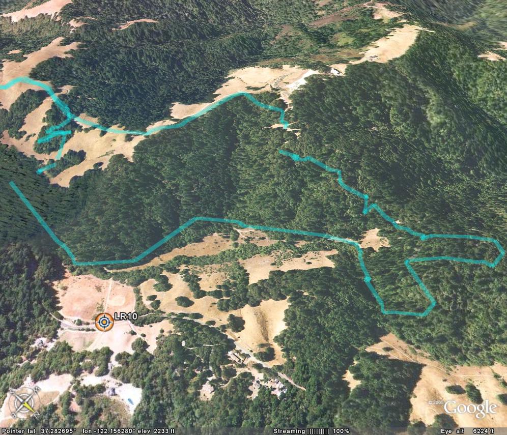
(This map comes from Dave Luke's page,
which also includes a high-resolution version (e.g., for printing).
John Blenio has also developed
a map of this area.)
OTE Ratings: O8/T6/E6
Distance: 10-15 miles
Climbing: very little (only a couple of hundred feet or so)
Time: 1.5-4 hours
USGS 7.5' topo: Mindego Hill (& part of Cupertino), CA

Description
Quite a bit of very nice legal (and official) singletrack, which is rare for
MROSD land. This ride is around 50% singletrack, 50% fire road. Good views
of Big Basin and Butano Ridge to the southwest. The singletrack (Peter's
Creek Loop) sections north of Ward Road are closed during the rainy season,
as the Krebs map says. Overall, this is a fun, relatively short ride.
Directions to the start
(N 37° 17.5', W 122° 09.1')
There is a dirt turnoff roughly half-way in between Page Mill Road and Highway 9,
on the eastern side of Skyline Boulevard. This is the Grizzly Flat trailhead.
An alternative starting point is at the "Saratoga Gap" parking lot at the junction
of highway 9 and highway 35 (Skyline Boulevard).
(N 37° 15' 30", W 122° 07' 12")
The ride
Cross Skyline and follow this singletrack down into Long Ridge OSP.
Immediately after the bridge, turn left on the fireroad (Peter's Creek Loop).
Continue up until the gate that says "Private Property" and bear to the
right along the singletrack past the lake (on your left). Take the
switchbacks up the hill until you reach Ward Road. Take a left on this dirt
road, and shortly thereafter, bear to the right onto the singletrack. After
you enter into the trees, look for a singletrack going up the hill on the
right. Take this short loop around the hill to where it rejoins the
fireroad. I saw several wild turkeys at the end of this section. Cross
Skyline again and take the singletrack into Upper Steven's Creek Park. Cross
sandy Charcoal Road and continue on the singletrack in Saratoga Gap OSP.
This is an especially nice two-mile stretch of rolling singletrack, carved
into a steep hillside. Follow this up the hill and to the end at the
Saratoga Gap parking lot and the intersection of Highway 9 and Skyline Blvd.
Here you can either retrace your steps or ride north (right) along Skyline
Blvd. back to the Grizzly Flat trailhead in order to save time. If you wish to
continue by trail, continue back along the singletrack you just came along,
back across Skyline, back along the fireroad to Ward Road. Instead of
turning right here, however, continue straight ahead, eventually turning
right onto the singletrack Peter's Creek Loop trail. Follow this around and
down the mountain. Take a left at the singletrack, and follow this back up
to the Grizzly Flat trailhead.
For a longer ride (with a tough climb!)
Take Grizzly Flat trail down from the parking lot instead of crossing over
Skyline to Long Ridge OSP. Go left at the singletrack across the creek,
right on Canyon trail, right on Table Mountain trail and right on Charcoal
Trail. Take a left onto the Saratoga Gap singletrack trail, follow this to
the Saratoga Gap parking lot, and follow previous directions for the return
to the Grizzly Flat trailhead.
Colin McCreight (cmccr@crystal.hillsborough.ca.us)
For more information
Return to the mountain biking page
©1995-2019 Ross Finlayson